

Friday, June 17, 2011
MLPA Blog Has Moved....
The Surfrider Foundation has consolidated all of our issue-based blogs into one Coastal Blog. Come check it out at www.surfrider.org/coastal-blog
Friday, December 17, 2010
Marine Protected Areas Adopted by Fish and Game Commission
Contact: Alexis Henry Surfrider Foundation Phone: (949) 732 6413 Fax: (949) 492 8142 Email: ahenry@surfrider.org |
Surfrider Foundation Issues Statement On Marine Life Protection Act.
San Clemente, CA (December 16, 2010) – After several years of hard work and negotiations, the California Fish & Game Commission approved a network of 36 Marine Protected Areas (MPAs) in Southern California – part of a statewide process required by the 1999 Marine Life Protection Act (MLPA). The MLPA’s goals are to: ‘set aside’ areas of the ocean to increase fish populations, enhance marine habitat, and improve recreational and educational opportunities. Research on MPAs from around the world proves that they create larger fish populations and increase biodiversity within their boundaries.
Over the past two years, the Surfrider Foundation worked tirelessly with diverse constituencies, including commercial and recreational fishermen, divers, surfers, kayak fishermen, environmental activists and beach goers to help provide balanced input during the MLPA process. The Foundation conducted extensive outreach by surveying members and non-members (nearly 550 people completed a survey); arranging and participating in “one-on-one” meetings with stakeholders including fishermen, ardent conservationists, ocean-users, and the chapters; holding community forums to discuss map recommendations; and attending all of the public meetings held during the two-year process. The Surfrider Foundation also created its own map that reflected views from both activists who wanted to maximize the size of the marine reserves and fishermen who wanted them limited. The organization submitted its map of alternatives to Fish & Game for consideration, and used it to determine support for the proposed alternatives.
 |
| Joe Geever, Policy Coordinator for Surfrider write his speech. |
At the end of the process, the Blue Ribbon Task Force reviewed all the proposed maps and introduced a hybrid called the Integrated Preferred Alternative (IPA)., When the Surfrider Foundation compared its map with the IPA, they decided that there was enough overlap in most places to support the IPA.
The California Fish & Game Commission chose the IPA map to undergo “environmental review” and the Foundation submitted comments on the Draft Environmental Impact Report. They also launched an “action alert” in support of the final map, the IPA. Over 2,400 Surfrider supporters sent letters to the Fish & Game Commission urging them to adopt the IPA.
In the end, some Surfrider Foundation members felt the IPA went too far, while many more felt it did not to protect enough area in Southern California. The Surfrider Foundation thinks the IPA met the goal of finding a compromise not only for those who worked so hard on the Regional Stakeholder Group process, but also for the diverse concerns of its membership.
“It was a rewarding experience to work with so many diverse voices involved in the process,” said Stefanie Sekich-Quinn, Surfrider Foundation’s Campaign Specialist. “While negotiations are always a delicate balance, we believe the final product is a science-based, fair-minded proposal that will help restore important ocean ecosystems.”
To learn more about Surfrider Foundation’s involvement in this two-year process, visit http://mlpasurfrider.blogspot.com/.
About Surfrider Foundation The Surfrider Foundation is a non-profit grassroots organization dedicated to the protection and enjoyment of our world’s oceans, waves and beaches. Founded in 1984 by a handful of visionary surfers in Malibu, California, the Surfrider Foundation now maintains over 50,000 members and 90 chapters worldwide. For more information on the Surfrider Foundation, go to www.surfrider.org. ### |

Tuesday, December 7, 2010
Yvon Chouinard, founder and owner of Patagonia, Opines about MPAs!
 |
| Photo: Branden Aroyan |
But it's not "just cool" that he created this policy....the logic behind the policy is even "cooler". He knows that if his employees surf, hit the slopes, hike, etc--engage nature--they will be better environmental stewards.
This article is very powerful to those of us at the Surfrider Foundation who have been working on the MLPA. We spent nearly 2 years working with diverse ocean users to find a successful way to implement the MLPA.
Here is one of my favorite quotes from Yvon:
"...the fishery management tools we have cannot restore the size and diversity of species that existed just a few decades ago. Marine Protected Areas (MPAs), however, have proven to be an effective tool for restoring this balance and improving overall ocean health."Surfrider knows there are many tools that can help restore our ocean, but MPAs represent a unique tool that rebuilds our ocean on a fundamental level.
Finally, we are stoked about Yvon's piece because he encourages people to attend the MLPA hearing on Dec 15 (more info about hearing in the blog below).
Read his piece here.
Tuesday, November 30, 2010
Historic Fish and Game Hearing Dec 15th. Attend the Adoption hearing!
The time has finally come. After two years of painstaking planning and public participation, the Fish and Game Commission will hold an historic MLPA hearing. This hearing, also known as "the adoption hearing" will solidify the future of Marine Protected Areas (MPAs) in southern California.
This is your last chance to attend and speak in support of MPAs.
Please attend! If you would like more information about the hearing and/or need help with specific talking points about the IPA map, please contact Stefanie at: Ssekich@surfrider.org
Fish and Game Commission
December 15, Wednesday
9am
Hotel Mar Monte
1111 East Cabrillo Blvd
Santa Barbara, CA
If you cannot attend, please take a moment to send a letter to the Commission asking them to support the IPA. Click here!
Thursday, October 28, 2010
Southern California One Step Away from a Network of Marine Protected Areas.
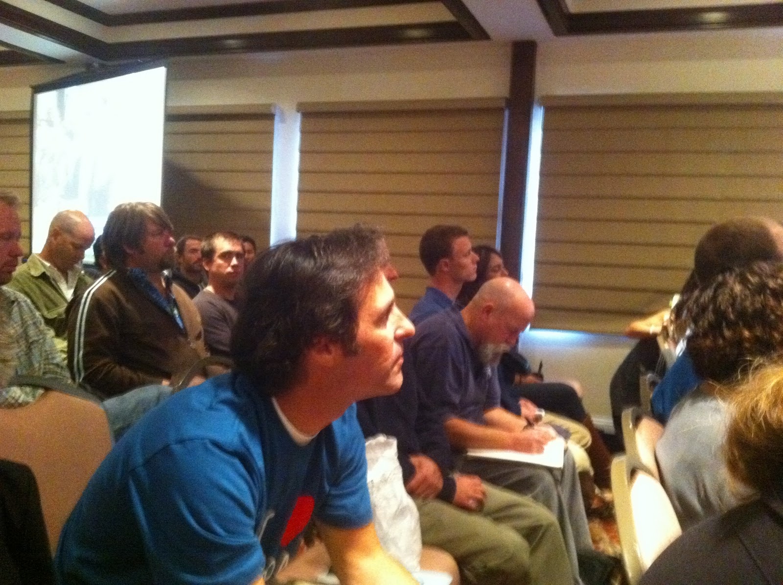
Last week, over 700 surfers, students, divers, business owners, and elected officials turned out in record numbers to the Fish and Game Commission hearing. This hearing was the last Fish and Game meeting before the Commission officially adopts a network of Marine Protected Areas (MPAs) in December. Here’s a great article about the meeting.
 |
| Just a handful of Surfrider representatives (Bill Hickman, Joe Geever and Julia Chunn) amongst the hundreds of people who attended the meeting. |
At the hearing, Surfrider representatives and local volunteers spoke in favor of implementing a strong network of MPAs and adopting the Integrated Preferred Alterative map (which the Commission has chosen to go forward under the State environmental review process; via the California Environmental Quality Act). After 2 years of planning, thousands of letters, and hundreds of hours of public meetings, the Fish and Game Commission will finally implement a network of MPAs at the Dec 15th meeting. Don’t miss your opportunity to attend the last hearing and speak in favor of Marine Protected Areas, AND witness the Commission make its historic decision.
If you are interested in attending this hearing (in Santa Barbara, please contact Stefanie at: Ssekich@surfrider.org).
Monday, October 11, 2010
Time and Date Set for Important MLPA Meeting. Please Attend!
October 20th is the date for one of the most (if not THE most) important meetings for the Marine Life Protection Act (MLPA) in the south coast region!
We need supporters of the final map (the Integrated Preferred Alternative (IPA)) to attend the hearing and show your support.
The meeting begins at 10am and they will take ‘public comment’ shortly after. You will more than likely have one-two minutes to share your support for the IPA. If you would like to attend and speak in support of the IPA, and need help with talking points, please contact Stefanie at: Ssekich@surfrider.org
If you haven’t already, please take 30 seconds to fill out our action alert asking the Fish and Game Commission to adopt the IPA here.
Fish & Game Commission Meeting
Date: October 20th, 2010
Arrival Time: 9:45am
Start Time: 10:00am
Location: Four Points by Sheraton
8110 Aero Drive, San Diego 92123 map
Actual Agenda: Click here
Arrival Time: 9:45am
Start Time: 10:00am
Location: Four Points by Sheraton
8110 Aero Drive, San Diego 92123 map
Actual Agenda: Click here
Friday, October 1, 2010
MLPA South Coast Updates
Mark your calendars! The Fish and Game Commission will be holding the final 'discussion hearing' about the MLPA process in San Diego on Oct 20-21 (we are still not sure what day they will specifically discuss the south coast MLPA, but mark your calendars, regardless). The final 'adoption hearing' will be in Santa Barbara (Dec 15-16).

In other Commission news... this week, the Commission held an "emergency meeting" to discuss delaying the final environmental review process--which would have been a set back for the implementation date. Fortunately the Commission voted to only postpone comments for the Draft Environmental Impact (DEIR) by 15 days instead of 45; so the hearings in San Diego and Santa Barbra are still on track.
In the next few days Surfrider will be re-launching our Action Alert asking the Commission to adopt the IPA (the final map that is before them). Surfrider spent the past 2 years meeting with a diverse community of people invested in the MLPA process and we believe the IPA map meets MLPA guidelines; contains viewpoints from conversationalists and fishermen alike; and in the end, the IPA will produce productive Marine Protected Areas in the future (which is vitally important to both the Surfrider Foundation and the Fish and Game Commission).
If you have questions about the upcoming hearings and would like to testify in support of the IPA, please contact Stefanie at: Ssekich@surfrider.org
Subscribe to:
Posts (Atom)

